My mom always go hiking at Setia Ecopark, Setia Alam with her friends but I’ve never been there because our schedule never matched. I wanted to go hiking one weekend but didn’t know where to go so I tagged along with them instead.
It was my first hike since my major surgery in end Jan to remove 26cm of my colon. #achievementunlocked

To my surprise, a number of Setia Alam residents did not know about this hiking trail that is located at Setia Ecopark 2, somewhere behind Setia City Mall.

To think back, it indeed looked like a trail less taken. There was no signage of the place at all. The entrance of the trail wasn’t the most obvious either. I learned online that it’s a community trail so it’s not something commissioned by the government or the area developer.

I’m not sure if it’s because I haven’t been hiking in a while or if it’s because the trail was indeed pretty mesmerizing. My mind kept going, “Wow. This is so pretty. Look at the trees. Look at the grass. Look at the branches.” This went on until we reached the first peak. The thing was that even though it’s easy to follow the trail throughout, it’s not the most obvious either. And it can get so narrow I wondered if it’s considered a trail even.
Another possibility could be that I just watched The Jungle Book and I couldn’t get the beautiful images out of my head.

Anyway, we started hiking rather late — past 8am I believe. So by the time we reached the first peak, the sun was up and I felt like running back to the trail. It was not comfortable at all because the peak was basically…bare. In fact, there were tractors flattening the terrain at the peak so I’m not sure how long this trail can last.

We walked a distance of red bare soil before getting back into shaded trail that led to the main peak, The Peak Garden. But by then, the sun from the first peak already cooked me up in my long sleeved top and sweat pants. My mom summoned me to cover up for fear of mosquitoes. But at that hour, the mosquitoes were probably asleep after their morning meal. So kill me. I was throwing up from the heat. No kidding.
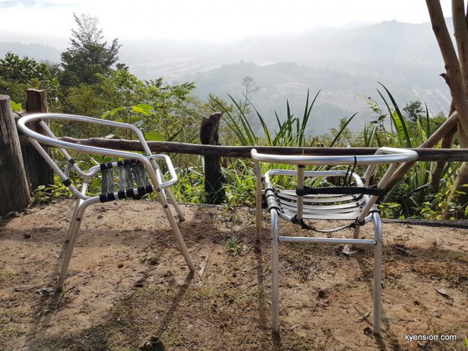
I rested for a while before continuing that remaining 50m to The Peak Garden. I was very seriously telling my mom that if the peak is not shaded, I would rather miss it than barbecuing myself again. Thankfully, it had shelters and a good view. Upon enquiry, we got to know that a team from North Star Tree Service had been maintaining the spot.
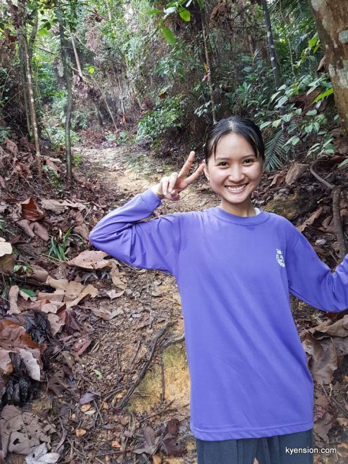
We took some photos to commemorate my first hike at Setia Ecopark and my first hike post-surgery.


We took Route A when we ascended but my mom’s friends suggested us to go by Route B for the descend since I dreaded the sun at the unshaded first peak.
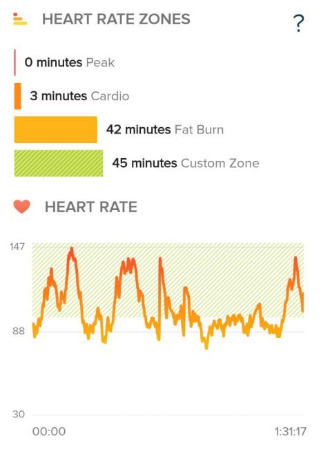
Honestly, Route A was considerably easy; I was panting because my stamina was horrible but it didn’t require me to exert myself physically. It was a slow ascend.
On the other hand, Route B was quite hardcore in my interpretation. There was a lot of steep and consistent descend (ascend if you take that route up). At one point, I felt the new joint of my colon twitching because I was putting so much pressure on my lower body. RK rescued me by letting me exert all the pressure on him so I survived the descend without further pain. #win

Unlike Route A where I was mesmerized by the beauty of nature, I learned that I have more fear in me now. It was for the good I guess. I was very afraid that I may slip and fall down the muddy path as I was descending. I was very afraid that I may cut or bruise myself from the contact with the plants around me. I froze every time I let go of RK. I used to quite confidently hop myself down similar descending trail. Anyway, better to be safe than sorry right? Especially because I was testing my new limit with this hike too.
All in all it was a good hike. I’d return at an earlier hour without my long sleeves and long pants. I’d take Route A up and Route B down if it hasn’t been raining and when I’m in shoes with better grip. Just hoping the hills haven’t been flattened up by those tractors when I’m ready to hike at Setia Alam again.


This community trail has a Facebook group with info and map on the trail: https://www.facebook.com/groups/Setiaalamtrail.
Update: I went back 6 months later and got lost hiking at Setia Alam.

I rarely leave any comment. But when I typed “how to get to Setia Alam hill”, your post came out top. I was glad it did, as I found your post simply interesting. I especially liked the photo where you drew the line to indicate the starting point-which is really helpful rather than using words to describe it. Will try it out this weekend-to signify my return to active lifestyle… Thank you for the info and godspeed in your health journey.
Glad to hear that you enjoyed the read and that it is helpful. Thanks for your kind words too. Hope you have a great time at the trail!
Hello! Thanks for sharing your experience. I’m going to try the trail. 😊
Hello! Thanks for sharing your experience. I’m going to try the trail. 😊
Hope you like the trail! More people are hiking there these days.