If you were to search for hiking spot in Shah Alam, it’s likely that you’d find Bukit Sapu Tangan hiking trail at the top of the list. In fact, besides the emerging Setia Alam hiking trail, I don’t remember learning about other hiking spot in Shah Alam.
The thing about Bukit Sapu Tangan is that it’s located in Taman Botani Negara Shah Alam; this means that you have to pay for the botanical garden’s RM3/pax entrance fee and RM3/car parking fee. Most hiking trails are free to access so this is quite a bane, especially if you plan to make this a regular spot.

On the other hand, the hiking trail at Bukit Sapu Tangan is all tarred and has a watch tower at the peak; a comfortable and clean trail plus a destination to look forward to sounds good, doesn’t it?

Don’t be relieved too fast.
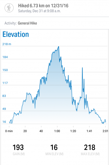
If you’ve heard or read that the trail is steep, I’m just gonna emphasize that a few more times. The trail is steep. The trail is so steep you wonder if car can go up easily. The trail is so steep you wonder if it’s worth it to reach the watch tower. The trail is so steep it tests one’s physical and mental endurance; more of the latter to be honest.

We started with a relatively easy walk from the entrance of Taman Botani Negara Shah Alam to the foot of Bukit Sapu Tangan, thanks to the direction given by staff at the ticketing entrance.


The start of the trail was very quiet when we started our hike at about 9am on a Saturday; we actually thought there was no one at all taking the trail when we were hiking in. There were signboards with wild animal warning so we were pretty terrified we’d run into wildlife actually. Nothing happened of course.

The trail was beautiful.

However, this beautiful trail didn’t distract us enough from the fact that all we could see in front was a very quiet and what seemed like an endless steep climb with no watch tower in sight. It was a struggle. And guess who gave up first?
Not me.
RK was worried we’d be mugged, be eaten by wildlife or break our legs about halfway in. He stopped walking and insisted to turn back. Guess who kept marching forward breathlessly and insisting this never ending steep road was a mental game.

RK had no choice but to catch up because I was out of sight ahead of him already.
I wished that stretch of steep incline where I told him, “let’s go up just this one more and see what’s up there,” was the last one but it was not. Thank God for the few hikers who were coming down, for cheating us that we were close.
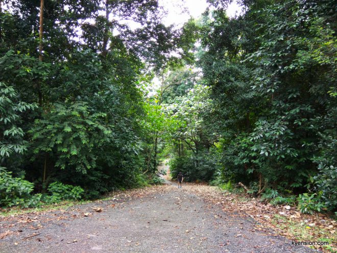
Every turn of the corner came with desperate call for the watch tower and no more steep incline. By the time we saw the watch tower, we were just plain relieved but no more energy to dash forward, especially not up the watch tower because it was broken!
Oh no.

But trust the monkey spirit in RK to defy gravity (or more like the broken staircase) to find his way up the watch tower. The tower’s a little flimsy with broken steps so this is definitely a do-it-at-your-own-risk move. Anyway, he only had the guts to go up because we heard voices up there; if they could do it, he could right?

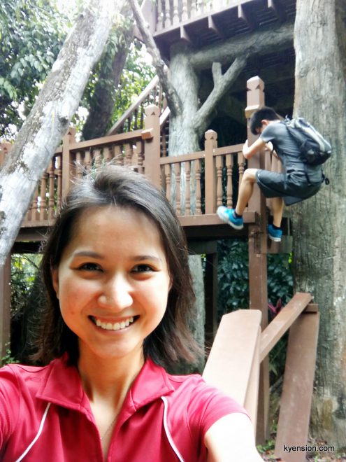

This hike definitely felt like an achievement to me because I was stubborn enough to not give up. Even though my motivation for this entire hike up was inaccessible, at least RK got to the top and took a panorama photo of the view for me ^^
With this little joy and pride, we slowly tackled the steep decline. It was faster to hike down of course. But it was still steep so we had to be more careful not to put too much pressure on our knees and toes. We didn’t want to roll down too for sure.
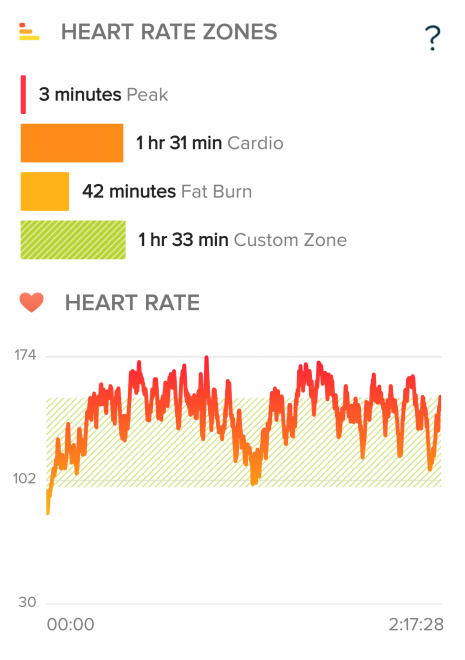
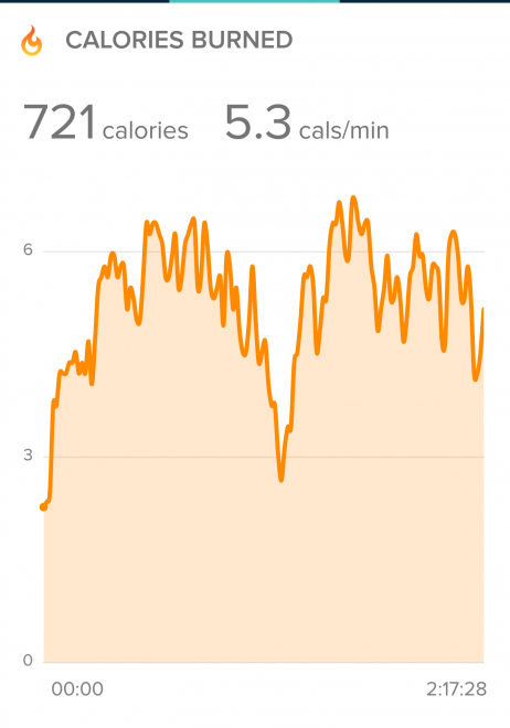
So if you enjoy a tarred trail that would get your heart pumping fast and hard from the steep climb, try Bukit Sapu Tangan; we did more than 6km in about 2 hours 20 minutes. It was a memorable one for me. Hope it’d be for you too for all the good reasons.
I’d rate the difficulty of this hike moderate because of the mental game and the steepness. Otherwise, the trail is easy to walk.


bikes (MTB) allowed on this trail?
Yes! I see cyclist cycle up the route.
Hi what app did you use ?
Hi! I used Map My Walk for location data and Fitbit for heart rate data.
I hike there alone and did just 1 hour including a bit rest and took some pictures. It is easy. Hehe
Thumbs up for you! I found it so tiring… Haha.
I hike there alone and did just 1 hour including a bit rest and took some pictures. It is easy. Hehe
Thumbs up for you! I found it so tiring… Haha.